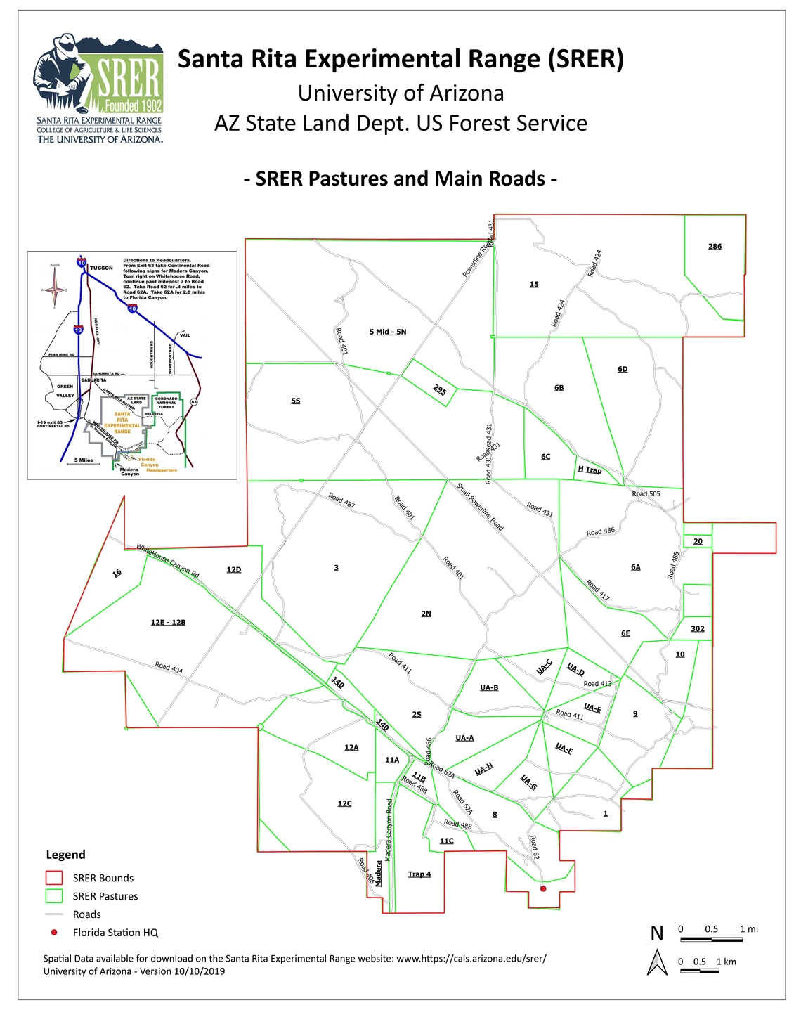
This is a collection of static maps showing roads, pastures, boundaries, and some historic uses. Spatial vector data of the SRER to be used with Geographic Information System (GIS) software can be downloaded at Spatial Data.
Links to other map resources are also provided.
Data users are requested to acknowledge their use of the database in publications, research proposals, websites, and other outlets by following the Instructions for Use, Citations, and Acknowledgement.
The Historical Maps of the Santa Rita Experimental Range (SRER) include:
- Map of the Santa Rita Experimental Range
- Physiographic map of the SRER, 1941 edition
- Map of the SRER showing locations of various mesquite and Lehmann lovegrass studies, 1972 edition
- Map of the SRER showing proportion of area allocated to grazing systems, watershed and revegetation studies, 1975 edition
These maps were created as a part of Appendix D of Medina's Annotated Bibliography (1903 - 1988) and their purpose was to assist readers in locating specific studies listed in the publication.
All maps listed above can be downloaded from this website at Appendices.
References
Medina, Alvin L. 1996. The Santa Rita Experimental Range: History and Annotated Bibliography (1903-1988). General Technical Report RM-GTR-276 Rocky Mountain Forest and Range Experiment Station Forest Service U.S. Department of Agriculture. 67 p.
A general map of the pastures and main roads of the SRER is available below for download. The same vector data files that appear in the map can be downloaded from this website at Spatial Data.

Historical and current Topographic Maps (scale 1:24000) including the area of the Santa Rita Experimental Range (SRER) can be downloaded from the TopoView page of the U.S. Department of the Interior Geological Survey (USGS) by searching or selecting the area of interest on the TopoView Map. Since 1884, the purpose of these maps has been to display the geography of the United States, including information such as place names, hydrography, and contour lines (USGS National Geospatial Program).
More particularly, the SRER is included in the following maps:
- Corona De Tucson
- Esperanza Mill
- Green Valley
- Helvetia
- Mount Wrightson
- Sahuarita
All topographic maps are available in different formats (*GeoPDF, *GeoTiff, *.JPEG, *.KMZ) for download.
Geologic Maps (1:24.000) including the area of the Santa Rita Experimental Range (SRER) can be downloaded from the Arizona Geological Survey Library by filtering the collection and area of interest.
Specifically, the SRER is included in the following Geologic Maps:
All maps are available for download in .KMZ format via the links above.
General maps showing the location and accessibility of the SRER and the Florida Station Headquarters :can be downloaded at SRER and Florida Station (SRER HQ) Maps and Accessibility.

