Santa Rita Experimental Range Archives
The four Appendices of Medina's publication Santa Rita Experimental Range: History and Annotated Bibliography (1903-1988) list soils, vertebrates, and plant species known from the SRER until 1988, and annotated historical maps for locating specific studies. All Figures included in the publication are also listed and commented to provide supplementary information on some of the research carried out on the range.
More recent data about soils, vertebrates, and plant species on the SRER as well as maps can be found on Data for download.
References
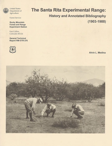
Medina, Alvin L. 1996. The Santa Rita Experimental Range: History and Annotated Bibliography (1903-1988). General Technical Report RM-GTR-276 Rocky Mountain Forest and Range Experiment Station Forest Service U.S. Department of Agriculture. 67 p.
Figure 17. Map of the Santa Rita Experimental Range

Figure 18. Physiographic map of the Santa Rita Experimental Range, 1941 edition

Figure 19. Map of the Santa Rita Experimental Range showing locations of various mesquite and Lehmann lovegrass studies, 1972 edition

Figure 20. Map of the Santa Rita Experimental Range showing proportion of area allocated to grazing systems, watershed and revegetation studies, 1975 edition

Figure 1. Location of the Santa Rita Experimental Range

Location of the SRER
Medina 1996
Figures 2-3-4. Photo sequence showing relative changes in density of mesquite between 1903, 1948, and 1988, looking east up Proctor Canyon. Mesquite density changed little on wooded draws compared to upland sites

Changes in density of mesquite between 1903, 1948, and 1988
Medina 1996
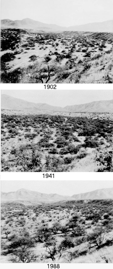
Figures 5-6-7. Photo sequence showing differences in range conditions and vegetational changes from grassland (1905) to a more woody type dominated by cactus (1941) to a mesquite savannah (1988). Vegetation species are native grassland species

Figures 8-9-10. Photo sequence showing differences in range conditions between 1910, 1951, and 1988. In 1910 and 1951, native vegetation was the dominant aspect, whereas in 1988 the understory has become largely a monoculture of Lehmann lovegrass, an exotic. Note also the change in woody composition similar to figures 5-7

Figures 11-12-13. This upland site changed from a native grassland site (1922) with few woody species to a mesquite-cactus-burroweed type (1947), to a mesquite-Lehmann lovegrass-dominated savannah (1988). Note that cactus has completely cycled through and Lehmann lovegrass has outcompeted burroweed

Figures 14-15-16. Photo sequence showing little encroachment by woody plants between 1936, 1959, and 1988. Range condition improved significantly, with native species still dominant in 1959. Pastures of this type are presently classified as monocultures of Lehmann lovegrass


